The backdrop to my interest in Cornish railways was completely providential. Born just below the hilltop of Mount Misery between Penzance and the fishing village of Newlyn, in a street probably intentionally named “Mount Pleasant”, the area was indeed a pleasant place to live. When I was 13 and granted permission to wander away freely by myself more, I discovered wider stretches of the hinterland of my home, and ultimately the railway – walking beside it far along the lanes towards St Erth. Because my father worked on the rail system from GWR days for 20 or so years, it had more of an allure than, say, farming or fishing or quarrying.
Most of these images are from postcards, and included to give some context and respite from the rather obsessive nature of the railway content to this website. I was fortunate, indeed, to have had such a happy upbringing, that engendered security in myself, and sufficient self-confidence to explore wider afield as opportunities presented themselves. Although Penzance is little changed, really, from those days, I include these images as historical markers, because more radical change may well come, and obscure the nature of the locality I grew up in.

A pre-war image of Penzance from the South West from an ‘Aero Pictorial’ sepia-toned postcard. The surrounding area is extensively countrified and the foreground shows the skerries and absence of beach sand that prevented the town from being a major resort. 3####AA01-PCE-TOWN—VI__N

The main thoroughfare of Penzance, Market Jew Street – well-populated with Summer visitors. Sir Humphry Davy’s statue fronts the Market House; and the station lies behind the photographer at the foot of this hill. Photo: A.W. Besley. Postcard: Colourpicture, Norwich. 6####FE01-PCE-TOWN–VI__W

Penzance promenade, looking east towards Newlyn from the Serpentine Company’s building, in the period before the Bedford Bolitho Gardens were destroyed in the 1963 storms. The twin-turreted building was the “Golden West Casino” in my time there. Postcard view. 6####FJ01-PCE-PROMD-VI__W
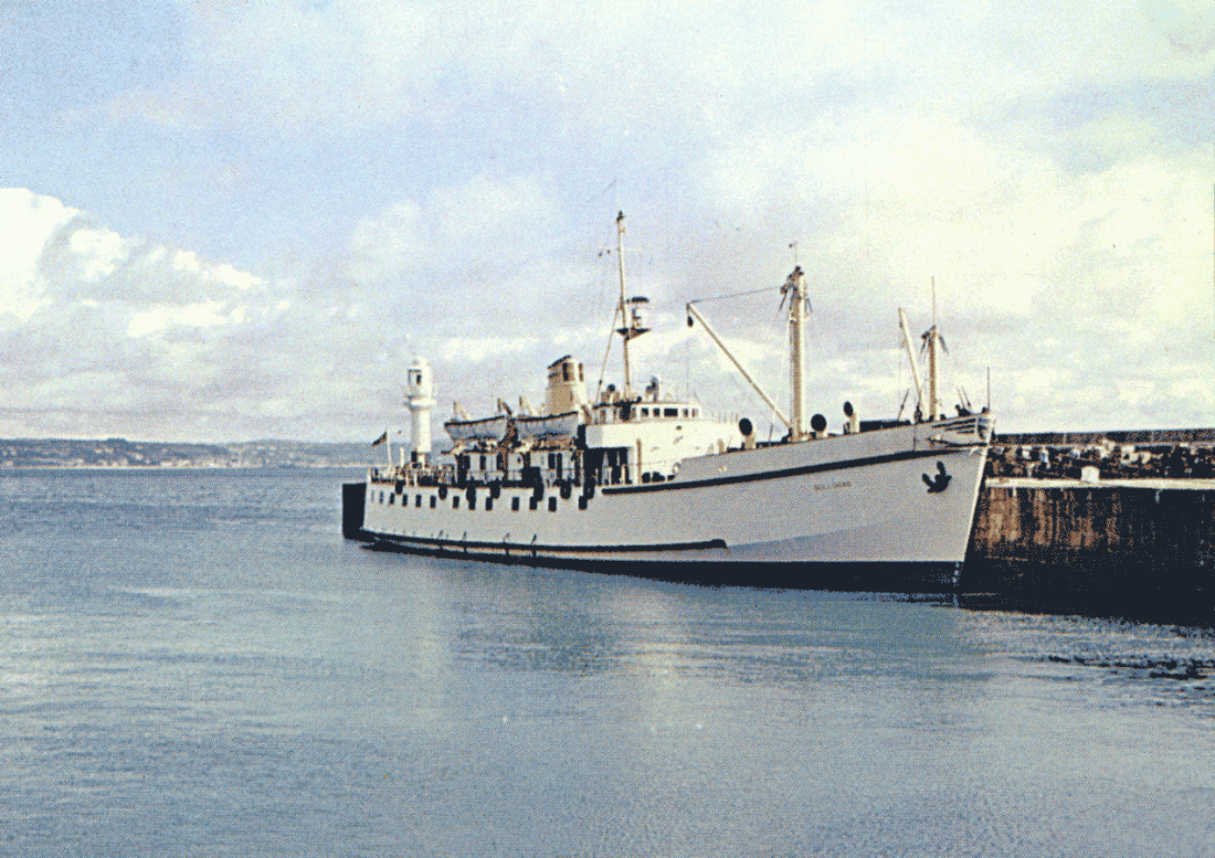
“RMV Scillonian” – the ferry to the Isles of Scilly – is pictured on a beautiful calm day, moored to the lighthouse pier at Penzance. Stores and cargo are placed neatly against the sea wall awaiting loading. Postcard photo: W.R. Bawden, Colourpicture Publishers, Norwich. 6####FL01-PCE-FERRY-PARKD

The promontory giving its name to Penzance (“Holy Headland’, in Cornish) is at the end of the promenade, where the Jubilee Swimming Pool has been built onto Battery Rocks. Holidaymakers make the best of the sunny, but cool weather. Postcard: Jarrold & Sons, Norwich. 6####FY01-PCE-PROMD-VI_NE
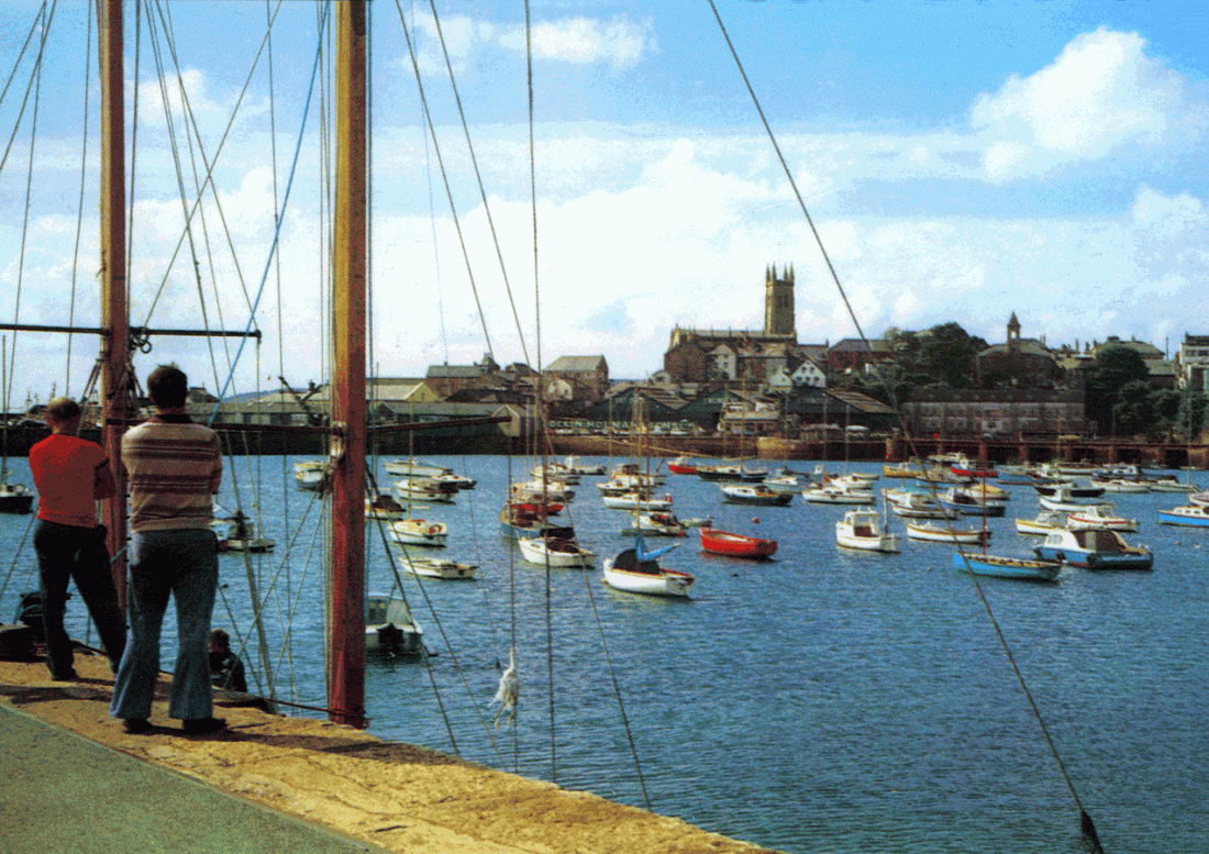
Yacht Club members look across Penzance Harbour towards Holman’s Ship Repairers. Small boats are moored here, among them my father’s, who also performed the duties of ‘Pilot Boatman’ for a couple of years. Postcard: Photo Precision Ltd, St Ives (Hunts) 6####GB01-PCE-HARBR-VI__S

This aerial view of Penzance 30 years beyond the previous one above, is from a picture postcard, showing the view north across the town. The railway station is at the far end of the harbour car park and curves away east along the sea front. Photo: T. Snell. Copyright: John Hinde. 6####GC01-PCE—TOWN-VI__N

Morrab Gardens at the centre of the town are a very pleasant place to visit. This view was taken in the early 60s before the green shelter was replaced by ‘Pengarth’, an all weather venue for the elderly. The palm tree displays the variability of the weather. 60###AE01-PCE-GRDNS-VI_NE

A postcard image of Penzance floating dock, lightly populated with boats on a fine day. In the left background a buoy is being hoisted by a Trinity House crane, whose premises are behind the dockside buildings. The granite bulk of St Mary’s parish church tops the horizon. 7####DV01-PCE-HARBR-VI_NW
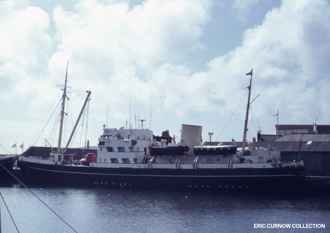
THV “STELLA” is moored in the floating dock at Penzance, closest to the Trinity House facility and Holmans Ship Repair business. This vessel was the base for maintaining the lighthouses locally, and a common sight anchored in the bay. 700831A01-PCE-STELA-MOORD

Newlyn Harbour looking towards St Michael’s Mount. In the foreground is the Old Harbour, where the smaller boats moor, and a few ‘Stevenson’ trawlers are behind, against the North Pier. Behind the building on the other pier is a stone boat awaiting its entry. 6806#AA01-NYN-HARBR-VI__E

Fishing boats are moored alongside each other against the north pier of Newlyn Harbour in the 1960s. If a boat was packed inside, cables would be slipped and boats moved to enable it to be disentangled. The high vertical walls without guard rails were quite terrifying to me as a little boy. 6####HA01-NYN-BOATS-MOORD

The North Pier of Newlyn Harbour, shows a coaster moored up awaiting loading of “blue elvan” from Penlee Quarry for shipment to Germany. Tracks at right show the tramway used for dropping stone through the screening and onto the conveyor. 6806#BK01-NYN-HARBR-VI__N

The area at Gwavas Lake, looking away from Newlyn. I remember the slip road, building (in a ruined state), tracks, and the silos just about seen on the horizon, but not the pylons – as well as the quarry further on to the right of the road while on a visit with my primary school. The quarry pit is a scary, sheer-sided, isolated place to visit today. 5#####999-NYN-QUARY-VI__S

Positioned on a concrete plinth at the neck of Newlyn’s South Pier are the remains of the former steam loco that plied the short line out to Penlee Quarry. It has been “tarted up” with corporate yellow, and has since been restored on a heritage railway. 720331A01-NYN-SLOCO-PARKD
